Free Camping Near Taos NM: Waterfalls, Hot Springs, and Wheeler Peak
Free Camping Near Taos NM: Waterfalls, Hot Springs, and Wheeler Peak
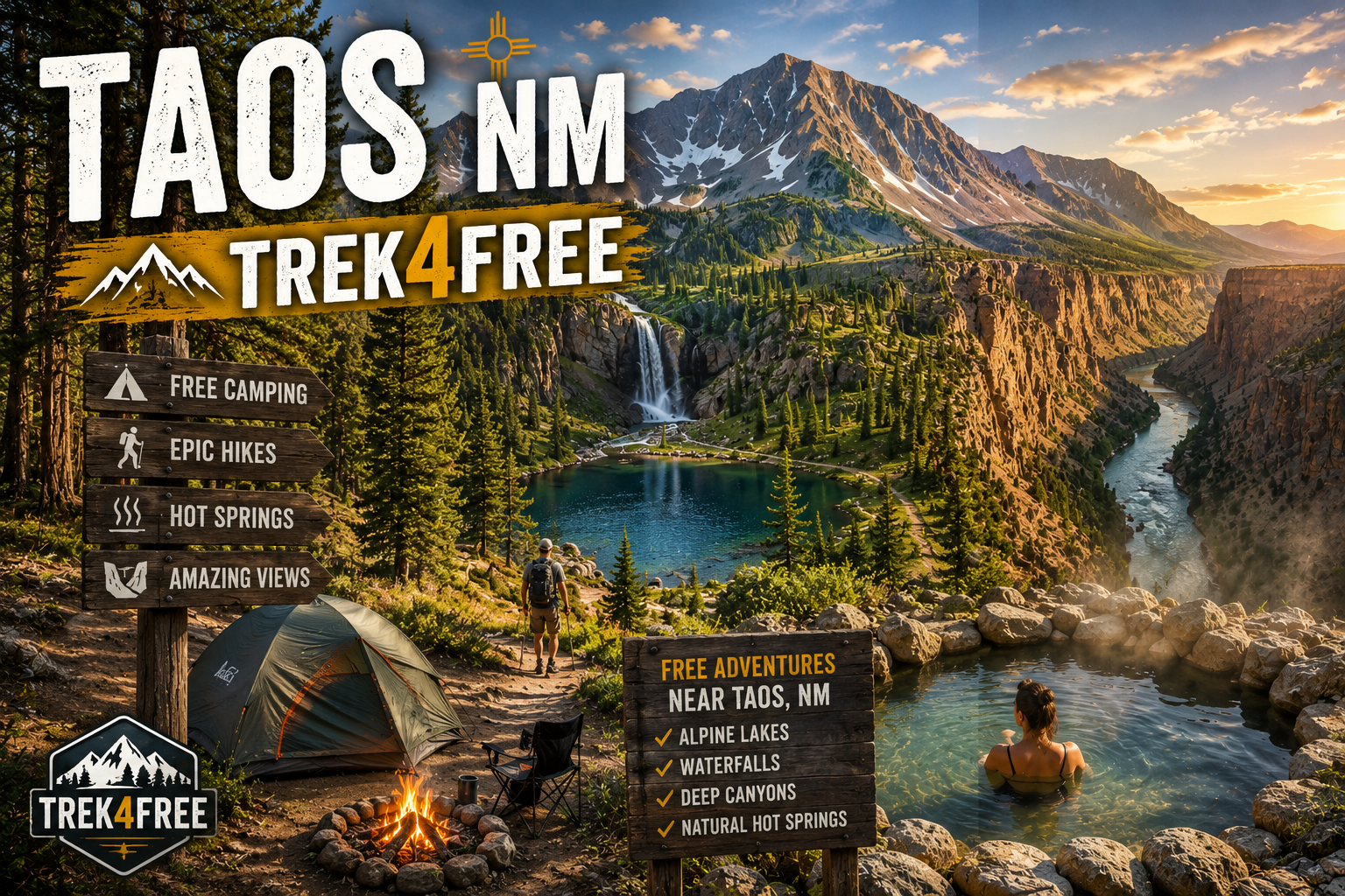
Taos sits at the base of New Mexico’s highest mountains, bordered by Carson National Forest to the east and the Rio Grande Gorge to the west. Most people come for the art, the pueblo, and the skiing. The people who know come for the free camping.
Carson National Forest allows dispersed camping throughout. The BLM land along the Rio Grande Gorge is open for free overnight use. Wheeler Peak — 13,161 feet, highest point in New Mexico — is accessible by a free trail from a free trailhead. Black Rock Hot Springs is a 0.3-mile walk from a free parking area. The whole setup is embarrassingly good.
Here’s the free camping guide nobody writes because everyone’s focused on the resorts.
Cuchillo del Medio — Your Base Camp
Free, 20 sites, vault toilet, Carson National Forest
The best free campground near Taos is 13 miles northeast of town on the road to Taos Ski Valley. Cuchillo del Medio sits along the Rio Hondo — shaded sites in the trees, river sounds all night, cool even in summer, and positioned perfectly for the two best mountain hikes in the area.
Cuchillo del Medio on Trek4Free →
Vault toilet on site. No water — bring your own. 14-day stay limit. Free.
From this campsite, two alpine hikes are within 15 minutes:
Williams Lake Trail → — 4 miles round trip, 1,000 ft gain to an alpine lake at 11,040 ft beneath the face of Wheeler Peak. One of the highest-rated hikes in New Mexico. Continue past the lake another 0.3 miles for a waterfall and views of the upper cirque. Free trailhead at the end of NM-150.
The Middle Fork Lake Trail leaves from the same area — 3.5 miles round trip to streams, cascades, and a second alpine lake with fewer people than Williams Lake. Same trailhead access road, same free parking.
El Salto del Agua Falls — The One Close to Town
Free waterfall hike, Arroyo Seco area, 20 minutes from the plaza
Most people visiting Taos skip this entirely because it’s on a road that doesn’t look like it leads anywhere. It leads to a multi-tiered waterfall with a cave behind the upper falls and cold plunge pools below.
El Salto del Agua Falls on Trek4Free →
About 1.5 miles round trip, 400 ft gain. Steep in sections. The upper falls has a ledge you can stand behind — the same walk-behind experience as Moore Cove in North Carolina but in the high desert with pinon and juniper instead of rhododendron. Bring water. Start early in summer — exposed trail, gets hot fast.
Dispersed camping along the river near Arroyo Seco gives you a free base close to this trail. The artsy village of Arroyo Seco is 10 minutes away for food and coffee.
Rio Grande del Norte National Monument — Canyon Camping
Free BLM dispersed camping, 800-foot gorge views
The Rio Grande Gorge splits the high desert plateau about 20 miles west of Taos. The whole area is Rio Grande del Norte National Monument — BLM land, free dispersed camping throughout.
Rio Grande del Norte West Rim Trail →
The West Rim Trail runs 9 miles along the canyon edge. Most people hike the first 2–4 miles for the best views — the gorge drops 800 feet straight down to the river and the views extend for miles in every direction. Bighorn sheep are common on the canyon walls. No fee, no reservation.
Camp anywhere on the BLM land near the monument boundary. High-clearance helps on some access roads. Bring everything — no water, no facilities out here. This is the remote version of the Taos experience: no neighbors, canyon silence, stars without light pollution.
The Rio Grande Gorge Bridge on US-64 is close — worth the stop. It’s one of the highest highway bridges in the US and the view straight down to the river is legitimately vertiginous.
Black Rock Hot Springs — The Reward
Free, natural, 97–101°F, 35 minutes from Taos
The best free hot spring near Taos is not the well-known resort version. It’s a 0.3-mile walk from a parking area near the John Dunn Bridge, down to primitive pools on the bank of the Rio Grande.
Black Rock Hot Springs on Trek4Free →
Temperature runs 97–101°F. The pools are tucked between boulders at river’s edge with 800-foot canyon walls above. Best in fall and winter when the air-to-water contrast is greatest. Free. BLM land. No facilities.
Note: avoid during high runoff season (late May–June) when the Rio Grande can rise and flood the lower pools. Check river levels before making the drive.
Manby Hot Springs is often mentioned in Taos hot spring guides — it’s currently inaccessible due to private land. Black Rock is the real one.
The Quick Reference
| Spot | Drive from Taos | Type | Best For | Fee |
|---|---|---|---|---|
| Cuchillo del Medio | 25 min | Free campground | Alpine hike base camp | Free |
| Williams Lake Trail | 30 min | Day hike | Alpine lake + waterfall | Free |
| El Salto Falls | 20 min | Day hike | Waterfall + swimming | Free |
| Rio Grande del Norte | 35 min | BLM dispersed | Canyon camping, bighorns | Free |
| Black Rock Hot Springs | 35 min | Hot spring | Natural soak on the Rio Grande | Free |
All free and dispersed camping in New Mexico is on Trek4Free: Browse NM free camping →
Every listing links to a map, weather forecast, and nearby outdoor spots within 8 miles.
New to dispersed camping? What nobody tells you about your first dispersed camping trip →. More in the region: free camping near Knoxville TN → and free camping near Asheville NC →.