The Mound Builders and the Bones That Disappeared
The Mound Builders and the Bones That Disappeared
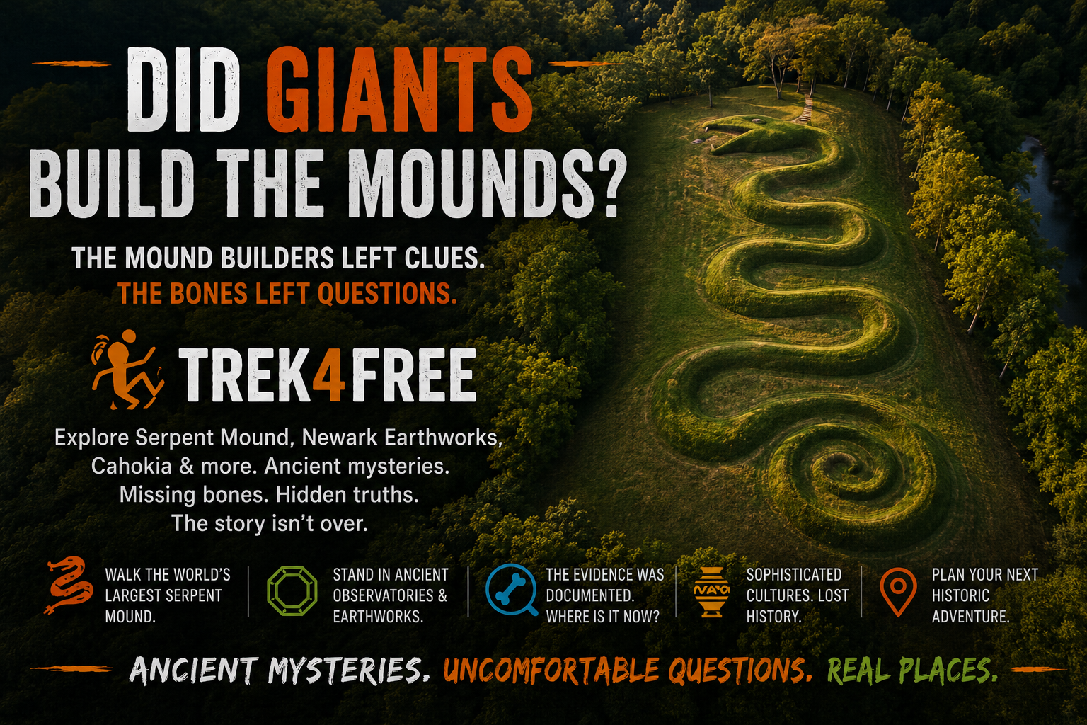
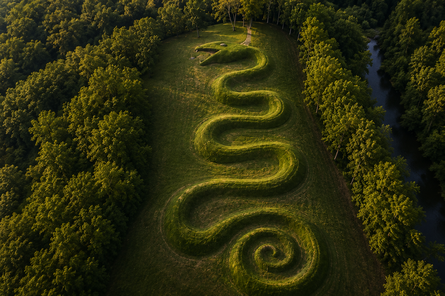
Drive to Adams County, Ohio. Find the observation tower at Serpent Mound. Climb it.
Below you is a 1,348-foot earthen snake coiling across a plateau above Brush Creek — seven curves, a spiral tail, jaws open around an oval form. The whole shape is only visible from above, which means whoever built it either had no intention of seeing it the way we see it, or had a reason to build something meant to be seen from a perspective they couldn’t reach.
It sits inside an ancient meteorite impact crater. The serpent’s head aligns with the summer solstice sunset.
The people who built this — the Adena culture, roughly 800 BCE to 100 AD — also built hundreds of burial mounds across the Ohio Valley. When the Smithsonian Institution surveyed those mounds in the 1840s, they documented what was inside. Their own reports describe skeletal remains that made the surveyors stop and measure twice.
Those remains are now in institutional custody. The record after that point is incomplete.
What They Built
Before getting to what was found inside the mounds, it is worth understanding the scale of what the Hopewell and Adena cultures built — because the engineering alone is enough to make you rethink the standard assumptions about who was living in North America two thousand years ago.
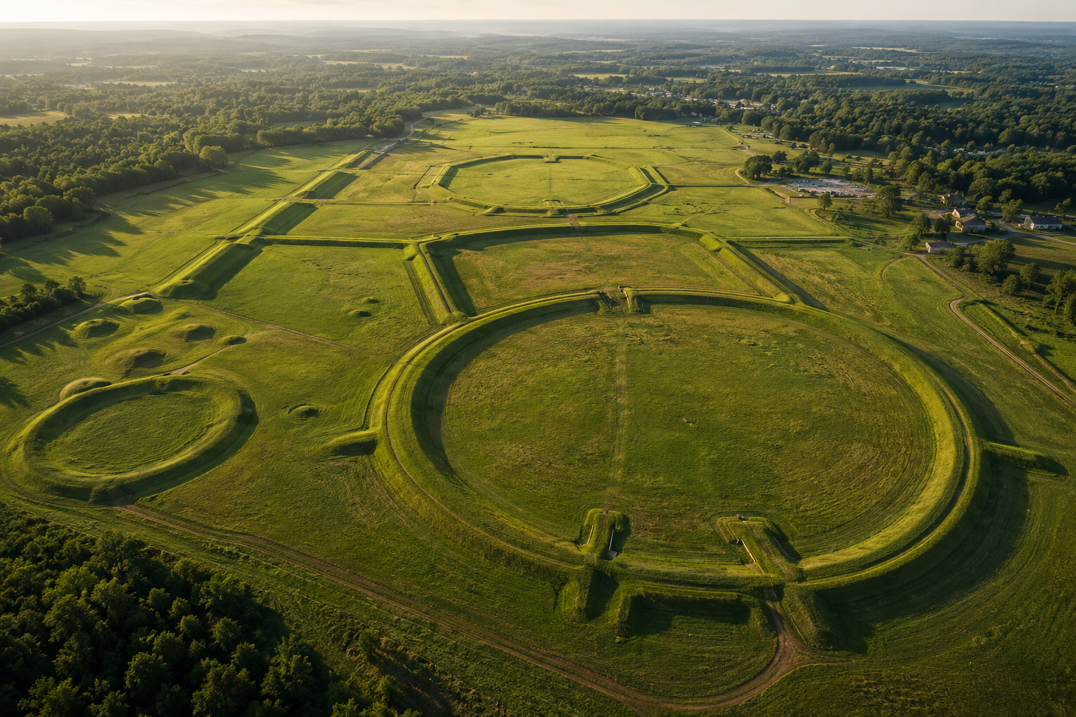
The Newark Earthworks in Licking County, Ohio covered four square miles at their peak — the largest geometric earthworks ever constructed anywhere on Earth. The Octagon Earthworks, the centerpiece, are precisely aligned to the 18.6-year lunar standstill cycle — the slow wobble of the moon’s orbital plane that repeats every 18 and a half years. The alignment is not approximate. It is architectural. The earthworks function as a lunar observatory that required multi-generational observation to design and multi-generational labor to build.
Those earthworks currently sit on a private golf course. Public access is limited to four days per year. It is a UNESCO World Heritage Site. You play golf on it.
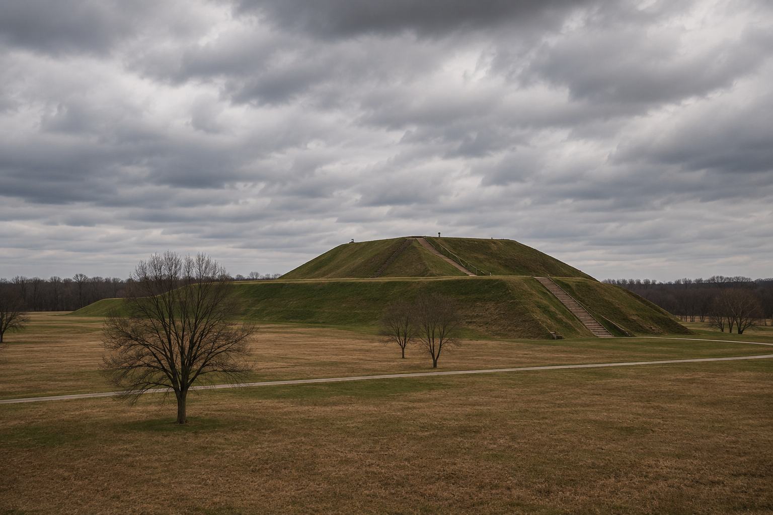
At Cahokia in Illinois, the central pyramid — Monks Mound — is larger at its base than the Great Pyramid of Giza. At its peak around 1050 AD, Cahokia was home to an estimated 10,000 to 20,000 people. It was the largest city in North America north of Mexico. Most Americans have never heard of it. It is eight miles from downtown St. Louis.
What the Surveys Documented
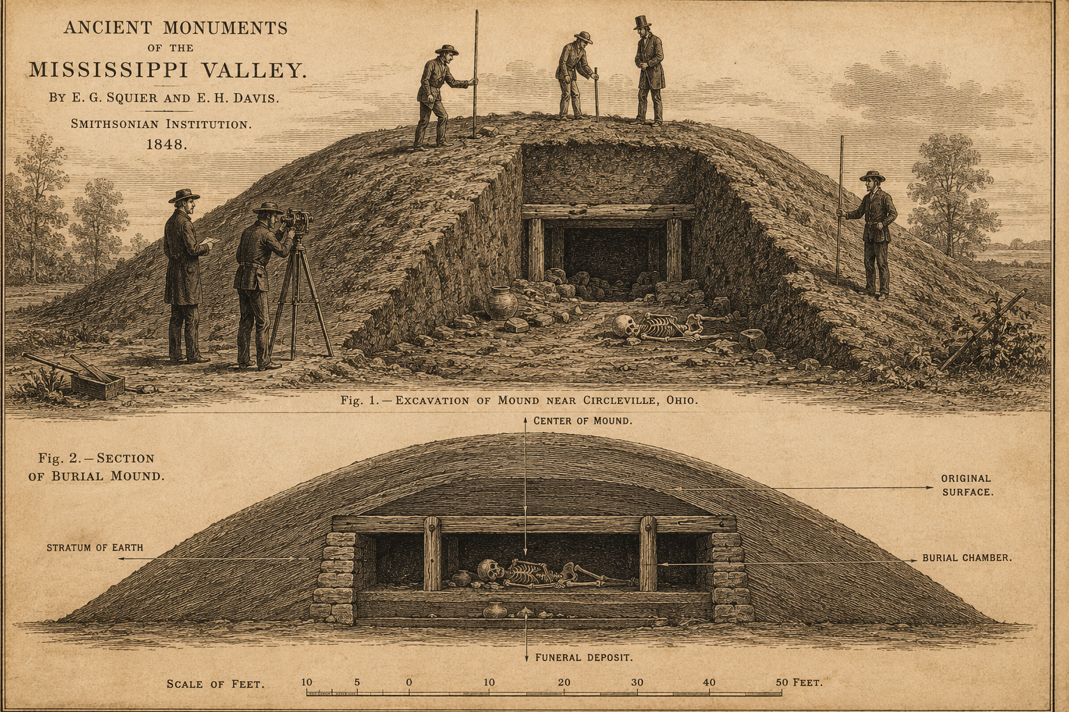
In 1848, Ephraim George Squier and Edwin Hamilton Davis published Ancient Monuments of the Mississippi Valley — the first major systematic survey of the Ohio Valley mound complexes. It was published by the Smithsonian Institution as the first volume of their Smithsonian Contributions to Knowledge series. This is not a fringe document. It is the Smithsonian’s own foundational work on American archaeology.
Their survey documented skeletal material from multiple mound sites across Ohio. In several locations they noted remains of unusual size — bones proportioned for individuals significantly taller than the regional average. They were careful about it. They were not sensationalists. They measured what they found and wrote what they saw.
The Bureau of American Ethnology, created by the Smithsonian in 1879 specifically to document Native American culture and history, continued this work. Their annual reports through the 1880s and 1890s include field documentation from mound sites across the Ohio Valley, Wisconsin, Iowa, and the Mississippi corridor. The reports are available. The language describing skeletal dimensions is consistent across multiple independent surveyors at multiple sites.
The Smithsonian’s own 1894 report on the Dunleith Mound group in Illinois documented remains measuring over seven feet. Reports from Ohio’s Scioto Valley mound groups, from Wisconsin effigy mound excavations, from burial complexes near what is now Effigy Mounds National Monument in Iowa — the language recurs. Larger than expected. Unusual size. Careful language from careful people who had no obvious reason to fabricate.
After the BAE received custody of skeletal material from these sites, the physical record becomes harder to trace. Institutional disorganization is a real explanation — the Smithsonian in the 1880s was not running a modern digital archive. But the pattern is specific enough and consistent enough across enough independent sources that disorganization alone is a thin answer.
The Repatriation Question
In 1990, Congress passed the Native American Graves Protection and Repatriation Act — NAGPRA. It requires federal agencies and institutions receiving federal funding to return Native American human remains and cultural objects to culturally affiliated tribes. This is unambiguously the right policy. The removal of remains from ancestral burial sites and their transfer to institutional collections without tribal consent was an injustice, and NAGPRA addressed it.
The practical tension is this: many remains from Ohio Valley mound sites were repatriated and reburied before modern DNA analysis, isotope ratio studies, and forensic anthropology could be applied to them. The same tools that confirmed the Hopi’s ancestral connection to Chaco Canyon and Petrified Forest — modern genetic analysis — could answer questions about the Adena and Hopewell populations that the 19th century surveyors could only describe in terms of what they saw.
Whether the answers to those questions would be surprising or unremarkable, we may not be able to determine from the physical record that remains. The reburial happened. The opportunity closed.
Tribes have an absolute right to their ancestors’ remains. And the questions the 19th century surveyors recorded are real questions that now have no clear path to resolution. Both of those things are true at the same time.
The Places Are Still There
The mounds themselves are not going anywhere.
Serpent Mound in Adams County, Ohio is open and walkable. The observation tower puts you above the coils. The meteorite crater it sits in is visible on topographic maps. The summer solstice alignment is real and repeatable — go on June 21 and watch it yourself. Small admission fee. Worth every mile of the drive.
Newark Earthworks — the Great Circle section is always open and free. Walking the perimeter makes the scale visceral in a way that no photograph manages. The Octagon is harder to reach but the Great Circle alone is worth the stop.
Cahokia outside St. Louis is free with a suggested donation, and the interpretive center is excellent. Climb Monks Mound. Stand at the top and look out across the Mississippi floodplain and try to picture 15,000 people living in the city below you in 1050 AD. It works.
Effigy Mounds in northeastern Iowa has 14 miles of hiking trails through hardwood forest past bear and bird effigy mounds overlooking the Mississippi River. Free entry. Practically no crowds on weekdays.
The people who built these places were sophisticated, precise, and connected across a trade network stretching from the Gulf Coast to the Great Lakes. What they looked like, exactly who they were, and what the 19th century excavation reports actually found — those are questions that the land still holds, even if the institutional record doesn’t.
You don’t have to go to Egypt for this. It’s an eight-hour drive from most of the eastern United States.
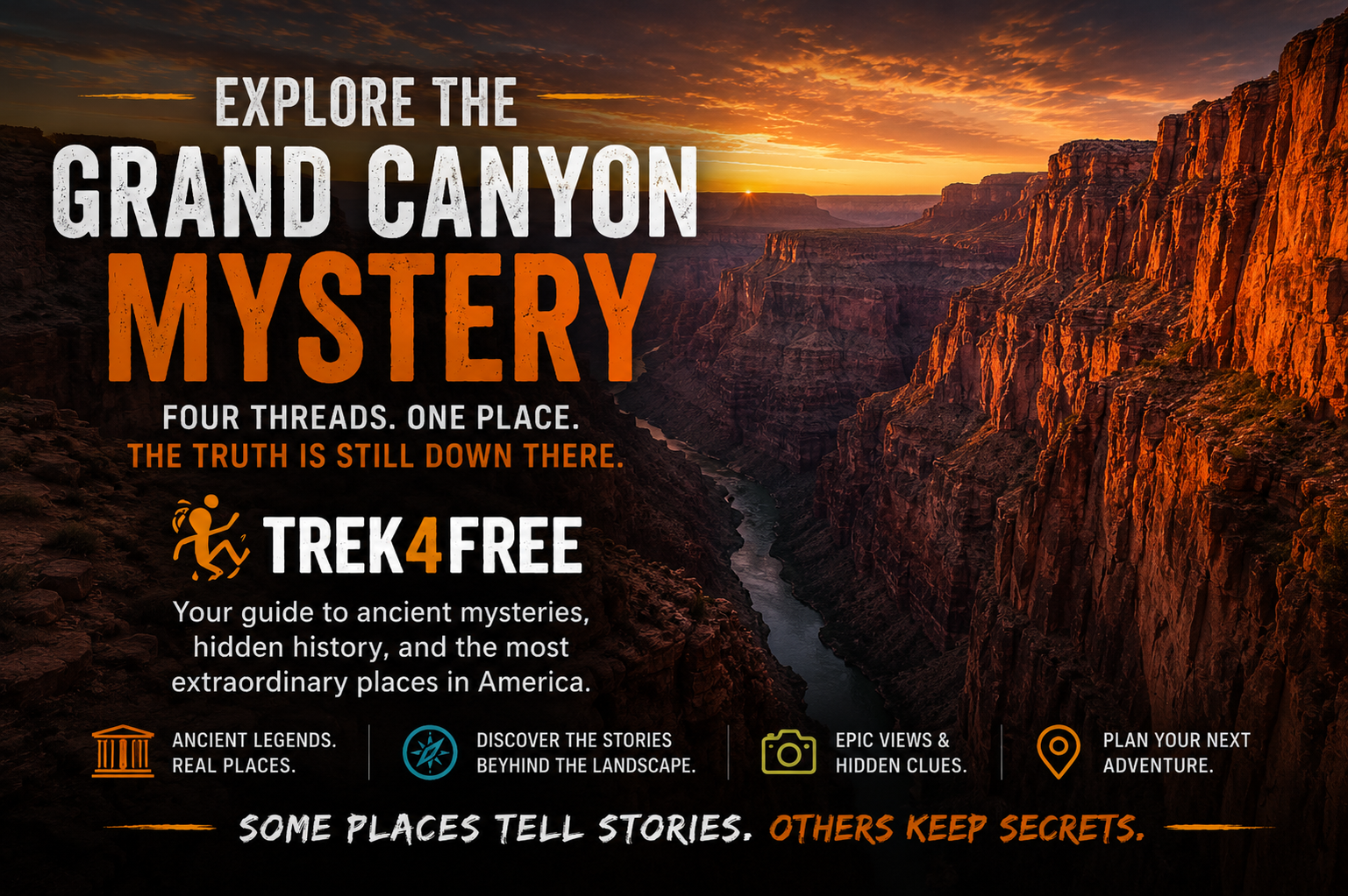
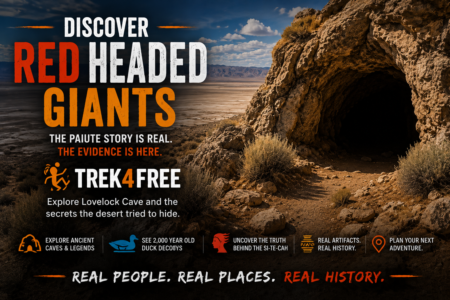
This is the third article in Trek4Free’s mystery series — places on public land where the documented record raises questions the official answer hasn’t fully closed. Start with the Grand Canyon and Lovelock Cave, then come back here. The same Smithsonian thread runs through all three. All sites appear on the Trek4Free Ancient Sites filter.