The Gunmaker, the President, and the Pirate: What Happened on the Lamar Peninsula
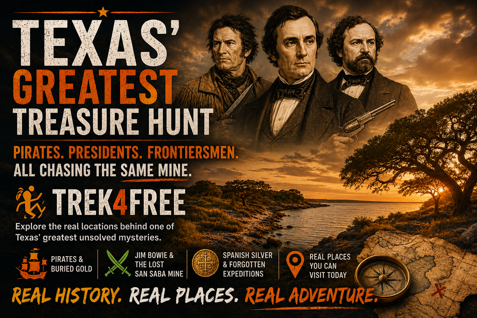
The Gunmaker, the President, and the Pirate: What Happened on the Lamar Peninsula
A pirate buried gold somewhere on the Texas Gulf Coast and then vanished without a confirmed death record.
The President of the Republic of Texas spent years trying to find him — and the gold.
The man who invented the Colt revolver, the gun that won the American West, quietly bought half the land at the exact spot those stories pointed to. He held it for five years and died without explaining why.
A whole town grew up on that peninsula, then disappeared. The cemetery was lost for thirty years under live oak brush until a historian tracked it down with an 1837 map. It’s been restored. The gate is still there. The graves of the men connected to all of this are still in it.
Nobody has found the gold.
That peninsula is ten miles long. It’s south of Rockport, Texas. You can drive the whole thing in twenty minutes. The live oaks are still bent the same direction they were when the gunmaker walked under them.
The Man Who Built It
Captain James W. Byrne was Irish-born, a veteran of the War of 1812 and the Texas Revolution, and before he arrived on the Texas coast, he had built prosperous careers in Ohio and New Orleans. He came to Refugio, fought at the Battle of Goliad, served in the Republic of Texas Congress, and in 1838 founded a bay town on Aransas Bay called Point Lookout — renamed Lamar a year later in honor of his friend, the President of the Republic. The full history of the town — named for a president, half-owned by a gunmaker, forgotten for thirty years — is documented at Lamar, Texas on Rockport Birding HQ.
His New Orleans business operations were substantial enough that he kept a bookkeeper there. That bookkeeper — Patrick O’Connor, descended from the last king of Ireland — followed Byrne to Aransas Bay and died in Lamar in 1854. He was the first person buried in the Lamar Cemetery. His headstone is still there.
Byrne’s wife Harriet was a relative of Rt. Reverend Jean-Marie Odin, the first Catholic Bishop of Texas — whose diocese centered on the Gulf Coast from New Orleans to San Antonio. The web of connections Byrne brought to this small bay town reached from the Texas Revolution to the corridors of the Catholic Church to the waterfront counting houses of New Orleans.
That waterfront was Jean Lafitte’s world.
The President
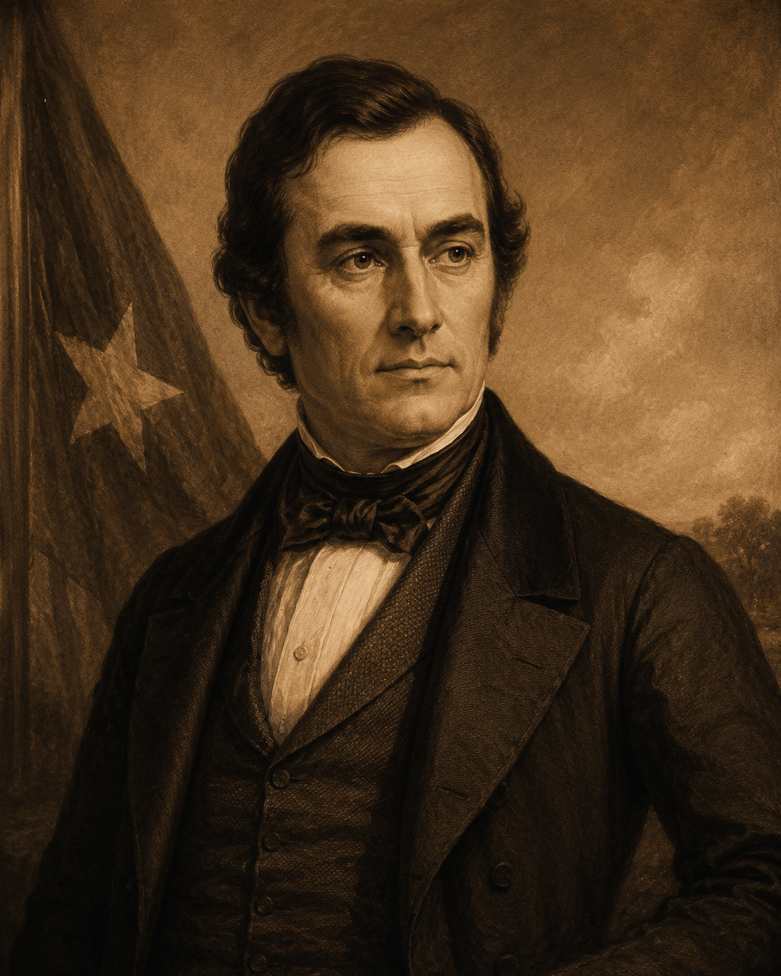
Mirabeau B. Lamar was the second President of the Republic of Texas, serving from 1838 to 1841. He was a complicated figure: he expelled the Cherokee from Texas, founded the University of Texas system, and wrote poetry. He was also, for years after leaving office, fixated on a question that other men dismissed.
Jean Lafitte had vanished.
Lafitte had operated his pirate colony at Campeche on Galveston Island from 1817 to 1821, when the US government forced him out. He sailed away. Official records state he died off Honduras in a sea battle in 1823. But the records were thin. No body was confirmed. No treasure inventory was ever produced. And the man who had run the most sophisticated smuggling network on the Gulf Coast — who had navigated the Spanish, French, Mexican, and American governments simultaneously for decades — left behind no clear accounting of what he had accumulated.
In 1843, Lamar investigated personally. He found no authentic death records. He found the stories of buried gold on the Texas coast very much alive. What he concluded, he kept to himself. For the full Lafitte story and what he did with four years on Galveston Island, read Jean Lafitte’s Texas.
The Gunmaker
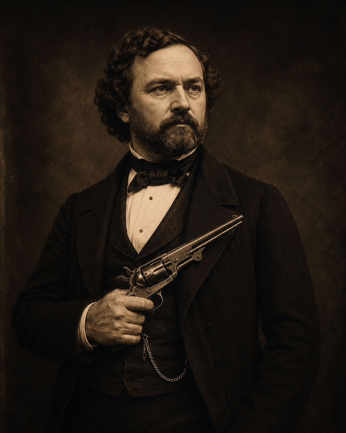
Thirteen years after Lamar’s investigation, Samuel Colt — the gunmaker from Hartford, Connecticut — acquired approximately a one-half interest in the Lamar townsite from Captain Byrne. Between 1856 and 1861, Colt held title to half the land under the small bay town on Aransas Bay. The Lamar Cemetery records confirm his presence. His heirs issued a quitclaim deed in 1870, eight years after Colt died in Hartford in 1862 — not in Lamar, despite what local legend has occasionally claimed.
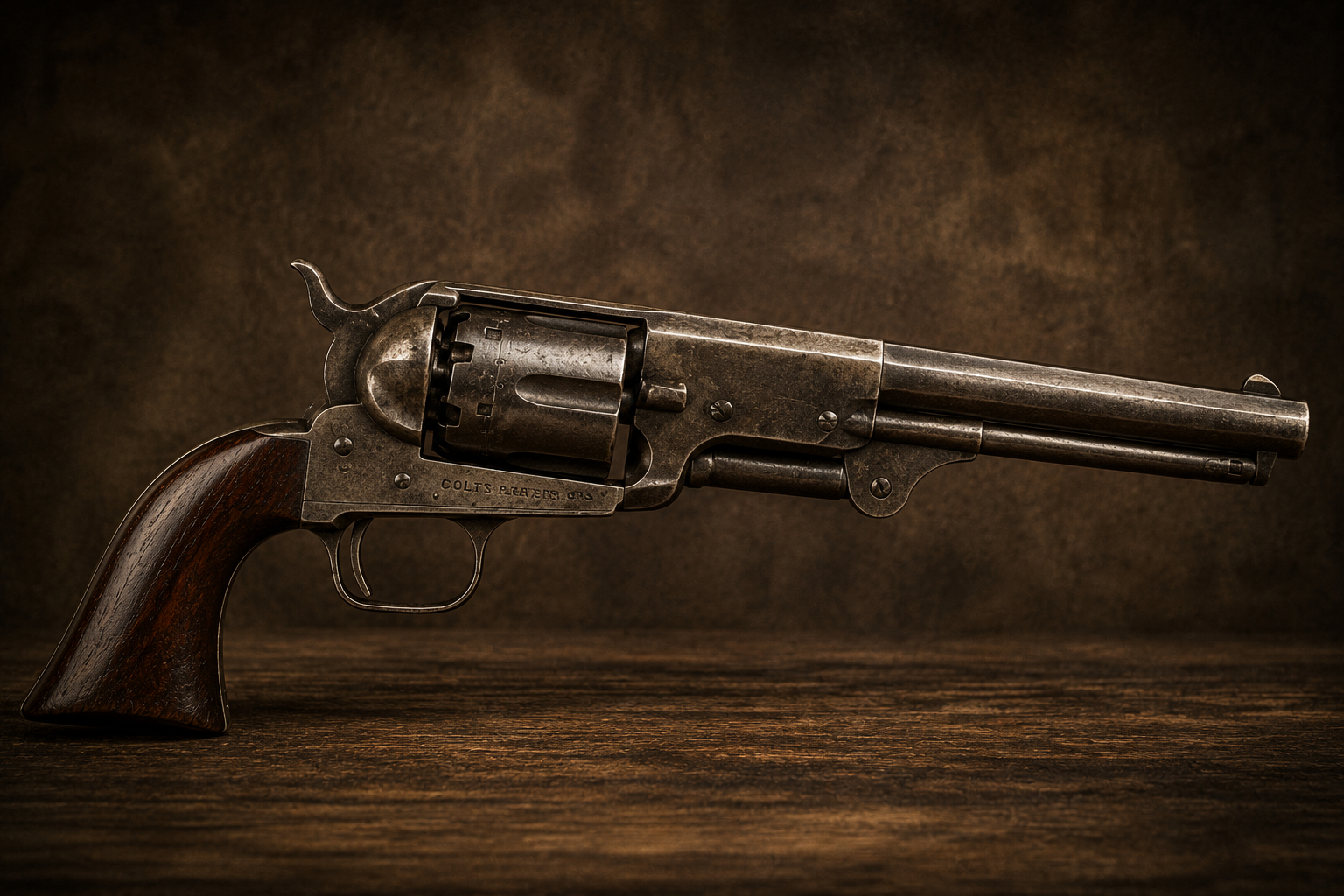
The timing is striking. The Colt Walker revolver — designed in collaboration with Texas Ranger Captain Samuel Walker, the most powerful handgun of its era and the weapon that defined the frontier — was developed in this same period. Colt’s working relationship with the Texas Rangers ran deep. Whether his ownership of land on Aransas Bay was a financial investment, a base of operations for Gulf Coast business, or something connected to the same stories that had drawn Mirabeau Lamar to this coastline years before, the historical record doesn’t say.
It just says he was here. And then he was gone. And the land eventually reverted.
The Ranger Who Rode These Shores
One more thread. The Colt Walker revolver — the weapon Colt designed with Texas Ranger Captain Samuel Hamilton Walker in 1847 — was not designed at a distance. Walker rode the Texas coast. According to the Texas Historical Commission marker at Rockport, Walker rode these very shores of Aransas Bay. The weapon that defined the frontier was shaped in part by a man who knew this specific stretch of coastline.
Colt’s land purchase on the Lamar Peninsula a decade later was not his first connection to it.
The Coast Between Them
The peninsula, the pirate, and the gunmaker all occupy the same stretch of Texas Gulf Coast — roughly 80 miles of barrier island and bay shoreline between Galveston and Corpus Christi.
Lafitte ran Campeche from Galveston Island. The Lamar Peninsula sits on Aransas Bay, 150 miles south. Mustang Island — one of the most frequently cited locations for Lafitte’s buried gold — lies between them, just south of Port Aransas.
And offshore, in 40 feet of water off Padre Island National Seashore, three Spanish galleons have been sitting since April 1554 when a storm tore the fleet apart. The San Esteban, the Santa María de Yciar, the Espíritu Santo — loaded with silver, gold coins, and cargo from New Spain, bound for Seville, gone in a night. Silver coins still wash up on the beach after storms. Metal detectors are banned at the national seashore. The recovered artifacts from the 1897 excavation sit at the Corpus Christi Museum of Science and History, two hours down the coast.
The same coastline. Three centuries of treasure. Multiple historically significant people acting on the same information.
The Town That Disappeared
Lamar never grew past a small port community. After the Civil War and the arrival of the railroad at Rockport, the town slowly emptied. By 1915 it had ceased to exist. The cemetery went with it — overgrown with live oaks, bay trees, and brush until most people forgot where it was. A 1952 San Antonio Express article called it simply “The Lost Lamar Cemetery.”
It was rediscovered and restored in the 1940s. The Texas Historical Commission marker went up in 1981. The gate is still there on Hagy Drive. Patrick O’Connor’s grave is still there. The Lamar Cemetery records still confirm Samuel Colt’s presence in this place. The historian who led the restoration noted that a special section of the cemetery had been set aside for the burial of enslaved people — and that more than a few of the graves belonged to men buried “with their boots on.”
A ghost town. A lost cemetery. A pirate’s bay. A president’s obsession. A gunmaker’s deed.
All on the same ten miles of peninsula.
The Treasure
Here is what the legend says, specifically.
When Lafitte abandoned Campeche on Galveston Island in 1821, he did not leave empty-handed — but he also could not take everything. Four years of privateering operations, smuggling, and trade had accumulated gold, silver, and coin that was not easily moved in a hurry. Local tradition along the Texas coast has always held that caches were buried at multiple points between Galveston and Aransas Bay before he sailed south for the last time.
The Lamar Peninsula appears in those traditions by name. Mustang Island — the barrier island just south of Port Aransas, between Aransas Bay and the Gulf — is the most frequently cited specific location in the written accounts. Lafitte knew both well. Aransas Bay was a staging area for his Gulf operations. The shallow-draft passes between the barrier islands were exactly the kind of navigation his operation depended on.
Mirabeau Lamar spent years after his presidency investigating whether Lafitte was actually dead and where the gold went. He found no death records. He found the stories very much alive. Samuel Colt, within fifteen years of Lamar’s investigation, quietly acquired half the townsite at the exact spot those stories pointed. Neither man left a record of what, if anything, they found.
Where to start if you’re going looking:
The Lamar Cemetery on Hagy Drive is the historical anchor — the oldest documented landmark on the peninsula, where the names of everyone connected to this story are recorded in stone. Walk it. Read the markers. The live oak canopy over the graves is the same one that was there when Colt held the deed.
From there, Lamar Beach on Aransas Bay is a short drive — public access, open shoreline, the exact waterfront where Lafitte’s boats would have worked. No restrictions on where you walk.
Mustang Island is accessible from Port Aransas. The state park beach on the Gulf side is open. The bay side facing Aransas Bay is where the legend concentrates. Texas law regarding found artifacts on state land is worth reading before you bring a metal detector — but walking the ground costs nothing.
Base camp options: Goose Island State Park sits directly on the Lamar Peninsula — campsites under live oaks, a short drive from the cemetery, right next to the 1,000-year-old Big Tree. It’s a paid state park but the most immersive base camp for this expedition. For free options: Magnolia Beach Park near Indianola is free primitive camping on Matagorda Bay — right at the northern end of the treasure coast, popular with van lifers and snowbirds. Port Aransas Beach Camping on Mustang Island puts you directly on the barrier island closest to the named treasure locations — tent, RV, or drive-on beach camping with no reservation required.
And if you make it to Padre Island National Seashore, the north beach is open and free. Metal detectors are prohibited in the historic shipwreck zone — but the coins from the 1554 Spanish galleons still wash up after storms on their own schedule, on a beach anybody can walk.
Nobody has found Lafitte’s gold. That is not the same as saying it isn’t there.
What’s Still There
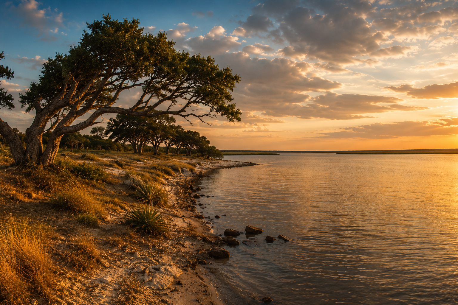
The Lamar Peninsula is still there. You can drive it in twenty minutes. The cemetery gate is still on Hagy Drive. The live oaks are still bent the same direction they were when Colt walked under them. Aransas Bay still looks the same at sunset.
You’re not reading about a distant place. If you live anywhere in South Texas, this is your coastline. If you’ve ever driven down to Rockport for a weekend, you’ve been on the same peninsula where the president and the gunmaker went looking for the same thing.
Nobody has found it yet. That means the expedition is still open.
The adventure was always here. It still is.
The full cast of Lamar Peninsula history — Lafitte, Walker, the Stella Maris Chapel (oldest structure in Aransas County, still holding mass), the 1,000-year-old Big Tree — is documented across 59 official Texas Historical Commission markers. Rockport Birding HQ has mapped and photographed all of them: Historic Markers of Aransas County. The Lamar Cemetery specifically: rockportbirdinghq.com/historic-markers/lamar-cemetery.
The Lafitte story: Jean Lafitte’s Texas. The Bowie and Lafitte article covers the Gulf Coast smuggling network and the lost Hill Country silver mine. All three Texas treasure stories connect to real outdoor destinations you can visit this weekend.