Half Dome: Yosemite's Ultimate Day Hike
Half Dome: Yosemite’s Ultimate Day Hike
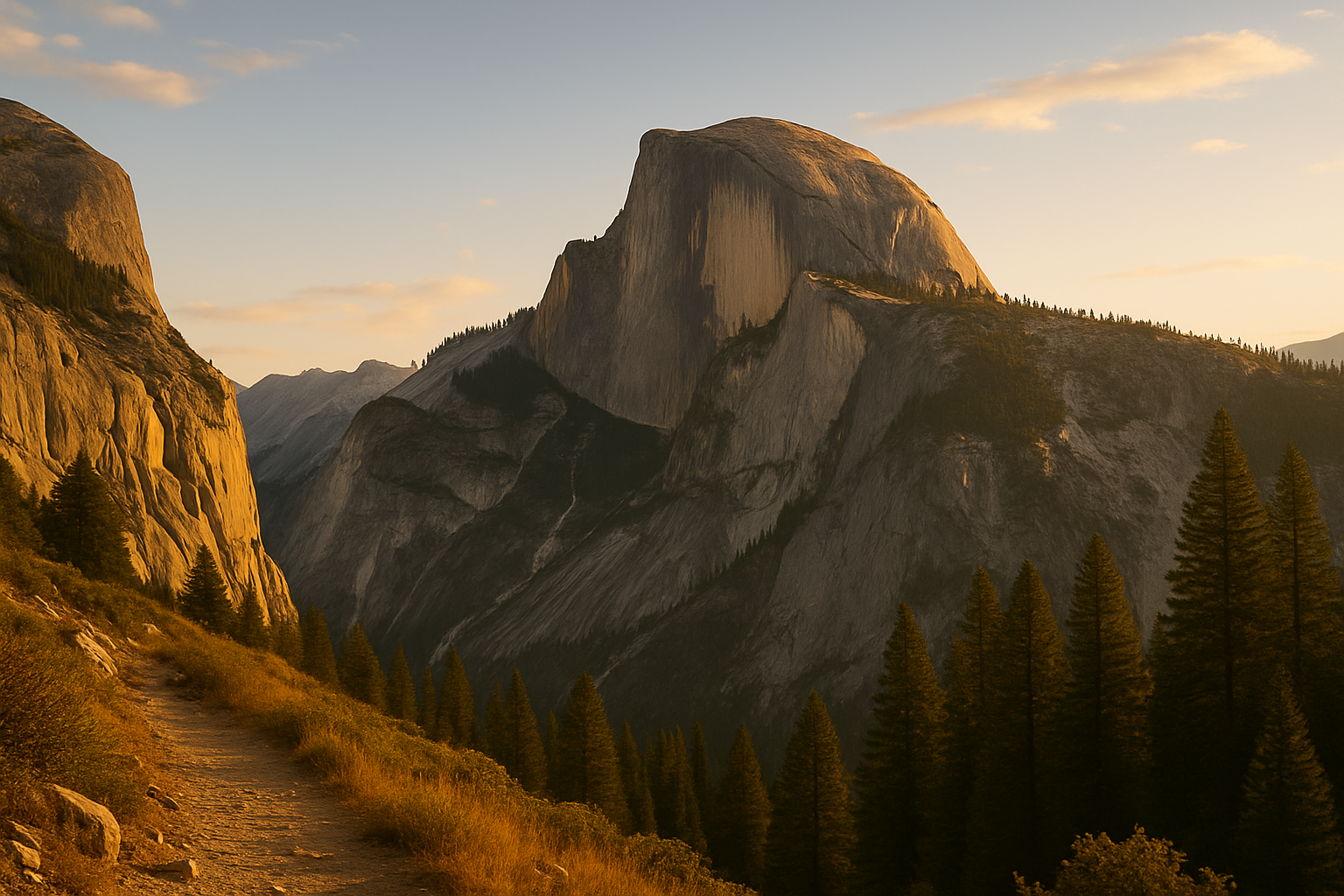
Half Dome looks impossible from the valley floor. It rises 4,737 feet above Yosemite Valley — a sheer granite wall sliced cleanly in half by glacial forces over millions of years. It is Yosemite’s defining landmark and, by most accounts, the best one-day hike in North America.
Getting to the top requires winning a permit lottery. That’s where most people start planning.
The Permit System
The cables section at the top requires a Half Dome permit. There are two ways to get one:
- Pre-season lottery: Opens in early March via recreation.gov for the cables season (roughly late May through mid-October). Apply here first — this is your best shot.
- Daily lottery: Each day, a smaller number of permits are released for two days out. Apply the day before your intended hike.
Only 300 permits are issued per day. Demand far exceeds supply, especially for weekends and the peak July–August window. Apply for your preferred dates and have backup dates ready.
No permit = no summit. Rangers enforce this at the base of the cables. It’s not a suggestion.
The Route
Distance: 14–17 miles round-trip depending on which trail you take Elevation gain: 4,800 feet Difficulty: Strenuous — one of the most demanding day hikes in the country Trailhead: Happy Isles, Yosemite Valley (accessible by valley shuttle)
Via the Mist Trail (most popular, 14 miles RT): This route passes Vernal Fall (317 feet) and Nevada Fall (594 feet) on a stone staircase that gets genuinely wet from spray. In spring it’s spectacular; in hot summer it’s a welcome cool-down. The falls section adds cumulative elevation but the scenery earns it.
Via the John Muir Trail (longer, slightly less steep): A drier alternative past Clark Point and through Nevada Fall from above. Most hikers combine both — Mist Trail up, JMT down — for a loop.
From the top of Nevada Fall, the trail enters Little Yosemite Valley before the long slog up the shoulder of Half Dome to the base of the cables.
The Cables
The steel cables run 400 feet up the final face of Half Dome at a consistent 45–60 degree angle. Wooden crossboards are bolted to the rock every 10 feet or so as footholds. Work gloves are strongly recommended — the cables are rough on bare hands, especially on the way down. Many hikers bring gloves specifically for this section and discard them at the top.
The cables are installed in late May and removed in mid-October. Don’t attempt Half Dome’s final face without them unless you’re a climber.
Lightning is a serious hazard. The bare granite summit is the highest point for miles. Storms build over the Sierra almost daily in July and August — typically arriving by early afternoon. Start by 6am and be off the cables by noon at the latest.
Overnight Option
Many hikers split this into two days, camping at Little Yosemite Valley Campground. A separate wilderness permit is required for overnight trips in Yosemite — apply through the Yosemite wilderness permit system (different from the cables permit). Sleeping at the valley eliminates the brutal early start and gives you the summit in morning light.
Summit Views
The view from the top is the Valley floor 4,737 feet below. El Capitan to the west. The Clark Range to the east. Tenaya Canyon cutting north. On clear days, the Sierra extends in every direction. The rounded granite surface of the top is roughly the size of 17 football fields — surprising how much space there is up there.
What to Bring
- 3+ liters of water, electrolyte mix
- Work gloves for the cables
- Microspikes if going early season (snow on the approach trail)
- Trekking poles (helps enormously on the descent)
- Headlamp for the pre-dawn start
- Layers — the summit is consistently 10–20°F cooler than the valley
Getting There
Yosemite Valley is 4 hours from San Francisco, 6 hours from Los Angeles. Park entry is $35/vehicle. The Happy Isles trailhead is accessible by valley shuttle — no trailhead parking. Reserve lodging or a campsite well in advance; Yosemite accommodations book out months ahead.
Coordinates: 37.7325°N, 119.5585°W | Yosemite National Park, CA