The Roanoke Triple Crown: Three Appalachian Trail Peaks Above Virginia's Valley
The Roanoke Triple Crown: Three Appalachian Trail Peaks Above Virginia’s Valley
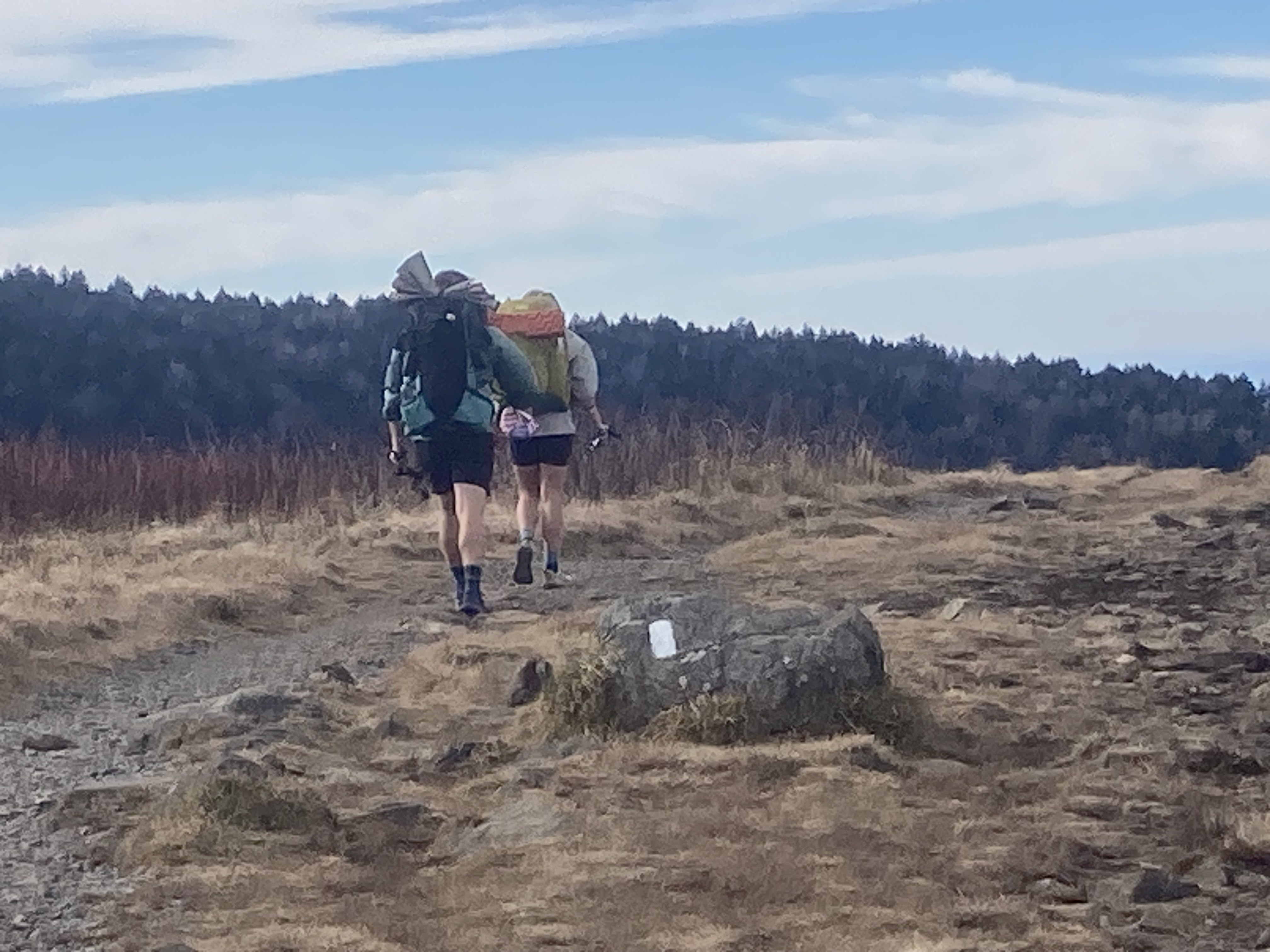
Last November, Amy and I were running the Appalachian Trail above Roanoke — one of those clear fall days where you can see forty miles in every direction — when we ran into Diana Christopulo on the trail near McAfee Knob.
Diana is a section maintainer with the Roanoke Appalachian Trail Club — the organization that has kept 120 miles of the AT in shape through this part of Virginia for decades. She was out doing what she and her fellow volunteers do: walking the trail, checking the blazes, making sure the thing is still there for the rest of us.
We talked for a while. She told us about the section, the club, the international visitors who make the pilgrimage to this stretch of the AT from South Korea, Israel, Germany, England — and trail maintainers from Japan who came specifically to see how RATC manages such a long section. There are license plates from Alaska in the McAfee Knob parking lot.
We hadn’t done all three peaks yet — we owe Diana a return visit. We built a Roanoke Triple Crown Challenge badge for it. When we finally earn it, we’re texting her.
What Is the Roanoke Triple Crown?
Three Appalachian Trail peaks in Jefferson National Forest, all within a roughly 20-mile stretch of trail above Roanoke, Virginia. Each one is a legitimate all-day destination on its own. Together, they are probably the finest concentration of AT day hiking in the entire 2,200-mile trail:
Dragon’s Tooth — a quartzite spire on the end of Cove Mountain’s ridge, 4.6 miles round trip with 1,150 feet of gain. The final scramble to the actual tooth is hands-and-feet on quartzite slabs. It is one of the more exciting conclusions to a day hike in the Mid-Atlantic. Some dogs need a lift over the last couple of moves.
McAfee Knob — the most-photographed point on the entire Appalachian Trail. 8.8 miles round trip, 1,780 feet of gain. That ledge jutting into open air over the Catawba Valley is the image you’ve seen. Now go stand on it. The views extend twenty miles in both directions on a clear day.
Tinker Cliffs — a half-mile continuous cliff band on Tinker Ridge with unbroken valley views and about half the crowd of McAfee. 11.8 miles round trip from the Catawba Valley Trailhead, 2,000 feet of gain. Often combined with McAfee Knob into a 16-mile loop — a big day, one of the best big days on the entire AT.
Trailheads and Parking
This is actually important. Diana flagged something in a recent conversation that saved people from driving to the wrong address: Google Maps has historically directed hikers to an incorrect location for McAfee Knob — someone’s house near the summit coordinates rather than the actual parking lot.
Use this address: 4440 Catawba Valley Dr, Salem, VA 24153. Type the street address, not “McAfee Knob trailhead.” You’ll end up at the correct USFS parking lot.
For Dragon’s Tooth, the trailhead parking lot is at the end of Dragon’s Tooth Road off VA-311 near Catawba, VA. The RATC website has the most current information for all trailheads in this section: ratc.org/at-hiking.
One heads-up: the Andy Layne Trailhead — the northern approach to Tinker Cliffs — is in the process of being relocated. Before you plan a Tinker Cliffs approach from that direction, check ratc.org/andy-layne-trail/ for the current access point. The Catawba Valley Trailhead (McAfee Knob parking) is the stable, confirmed option for all three peaks.
Free parking at all trailheads. No reservations. No fees.
The RATC: The People Who Actually Keep This Running
Every blaze you follow on this stretch of trail, every water bar that keeps the trail from washing out, every bridge over a creek, every blowdown cleared after a storm — that’s RATC. The Roanoke Appalachian Trail Club maintains 120 miles of the AT through this section, plus 16 trail shelters. Over 100 organized hikes per year. They’ve been at it since 1932.
Trail maintenance is not glamorous. It means showing up with hand tools, loppers, and saws on a weekend morning, walking a section of trail with a critical eye, and doing the kind of work that hikers only notice when it isn’t there. The people who do this work make it possible for the rest of us to have days like the one we had in November.
Diana is one of those people. She was out there with her crew of volunteers on a November weekday, the way maintainers do this work — without an audience, without recognition, without anyone noticing unless something goes wrong. She still took time to talk with two trail runners from Texas, answered every question we had, and sent us links.
If you run the Triple Crown and the trail is in good shape — and it will be — that’s RATC. Consider joining them, volunteering for a work day, or at minimum leaving the trail better than you found it.
Each Peak, in Detail
Dragon’s Tooth
Trailhead: End of Dragon’s Tooth Rd off VA-311, Catawba, VA → Trek4Free trail details Distance: 4.6 miles round trip Elevation gain: 1,150 feet Summit elevation: 3,020 feet
The trail follows the AT northbound from the parking lot, climbing steadily through mixed hardwood forest before the ridge begins to open up. The quartzite geology becomes visible — pink-white rock breaking through the soil — as you gain the ridge. The final approach to the tooth involves scrambling on exposed quartzite slabs at about a 45-degree angle; there are hand-holds and the rock is grippy, but it is genuinely a scramble, not a walk.
The views from the tooth itself are worth every move. You are standing on a narrow spire above a long valley, looking south toward McAfee Knob’s ridge in the distance.
McAfee Knob
Trailhead: 4440 Catawba Valley Dr, Salem, VA 24153 → Trek4Free trail details Distance: 8.8 miles round trip Elevation gain: 1,780 feet Summit elevation: 3,197 feet
The climb is sustained but never brutal. The trail follows the AT from the Catawba Valley parking lot through a series of switchbacks and a long ridge approach, emerging at the knob’s summit plateau before the short spur to the famous ledge. The ledge itself is a broad sandstone shelf extending out above the Catawba Valley — you can walk to the very edge and look straight down several hundred feet.
The photo you’ve seen — hiker sitting on the ledge with nothing but sky and valley below — was taken here. You will also take that photo. There is no avoiding it, and that’s fine.
Early morning on a weekday is the move. The knob at sunrise with no crowd is a different experience than the knob at noon on a Saturday in October.
Tinker Cliffs
Trailhead: Catawba Valley Trailhead (same as McAfee) or Andy Layne Trailhead (check ratc.org for current access) → Trek4Free trail details Distance: 11.8 miles round trip from Catawba Valley Trailhead (or ~16 miles as a McAfee loop) Elevation gain: 2,000 feet Summit elevation: ~3,050 feet
The cliffs run for over half a mile along the top of Tinker Ridge — a long exposed traverse above a continuous drop into the valley below. It is not a single viewpoint like McAfee or a single spire like Dragon’s Tooth; it is a sustained open walk along a cliff edge with views that keep going.
This is often the quietest of the three peaks despite being the hardest to reach from a mileage standpoint. The people who make it here tend to be serious hikers, and the trail accordingly has a different feel.
For a true Triple Crown day, start at the Catawba Valley Trailhead, hit McAfee Knob, continue north to Tinker Cliffs, loop back via the fire road — approximately 16 miles with significant gain. Bring food for that.
Do All Three, Earn the Badge
Trek4Free has a Roanoke Triple Crown Challenge badge. Complete all three peaks, check them off, download your badge. It’s free. It’s on the honor system. And until we earn ours, you’re going to be ahead of us.
We’ll be back in Roanoke. We’ll run into Diana again. We’ll have a better answer when she asks how the trails were.
Full trailhead information, current conditions, and volunteer opportunities: ratc.org. The Roanoke Appalachian Trail Club has maintained this section since 1932.